
Ha Giang Loop · Reference Guide
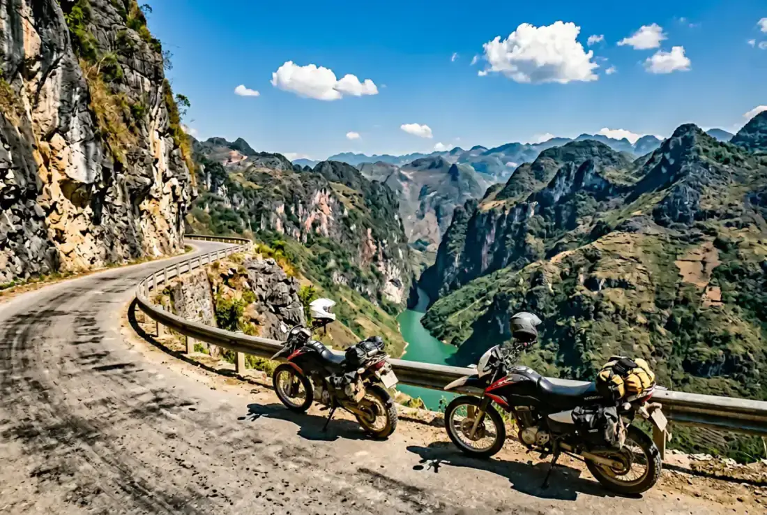
The Ha Giang Loop is a circular motorbike route through Vietnam's far north, running inside the Dong Van Karst Plateau Geopark — a UNESCO Global Geopark on the Chinese border. Most four-day programs start and finish in Ha Giang City, using established corridors through Quan Ba, Yen Minh, Dong Van, Ma Pi Leng, Meo Vac, and Du Gia. Day-by-day detail, verified waypoints, and the interactive route map are on this page below — this block covers logistics, format choice, and how this product fits our northern line-up.
Getting to Ha Giang City
Riding days begin and end in Ha Giang City — not Hanoi. Most guests arrive the day before departure via overnight bus, private transfer, or self-arranged transport from Hanoi (roughly 6–7 hours by road). Bike fitting, safety briefing, and the short control ride happen in Ha Giang on Day 1 before climbing Bac Sum Pass into the plateau. Hanoi pickup or return transfers can be quoted separately when confirmed in your written proposal.
Guide-led expedition vs self-guided loop
Many travelers rent a manual bike or easy-rider in Ha Giang City and ride the loop independently — lower cost, maximum flexibility, your own pacing. This product is different: a guide-led expedition for intermediate+ riders with daily weather calls, conservative group pacing (2–6 riders), verified corridor waypoints, mechanic sweep support when confirmed in your proposal, and accommodation registration handled for you. Choose self-guided if you want a map-and-rental weekend; choose this expedition if you want professional field support on a hardcore four-day loop. Independent budgets and guided program quotes vary widely by bike class, support level, season, and inclusions — see Investment on this page for what is included and what is not.
Dong Van Karst Plateau Geopark
The loop runs inside Vietnam's Dong Van Karst Plateau Geopark, recognized by UNESCO for its limestone karst, deep valleys, and highland ethnic communities — primarily Hmong and Tay villages above the clouds. The route uses real towns and passes local riders use every day: Bac Sum, Tham Ma, Ma Pi Leng above the Nho Que canyon, Dong Van Old Quarter, and Lung Cu near Vietnam's northernmost point. Season windows and booking fit are under Best Time To Go on this page and in the Ha Giang field guide. Licensing and insurance requirements for foreign riders are in our Vietnam motorbike license and insurance guide. More northern expeditions are on the North region page.
Road conditions and safety
Surfaces mix sealed mountain tarmac, broken edges, gravel patches, and village traffic. Weather can bring fog, cold, and wet roads — especially May through September. A guide-led program adjusts timing, route, and rest stops daily; support level, insurance, and emergency provisions must be confirmed in your written proposal before booking.
Which northern expedition is right for you?
Ha Giang Expedition (this page) — Four days on the classic loop arc when you want Ma Pi Leng, Dong Van, and highland villages at guide-led pace without two weeks away. Intermediate+ manual riders · hardcore · 4–6 hrs riding per day.
Northeast Border Expedition — Seven to ten days through Ba Be, Cao Bang, and Ban Gioc waterfall country, with optional extension toward Meo Vac and Dong Van. Choose this for longer border riding and lake-and-waterfall country — not a repeat of the four-day loop alone.
Northwest Loop Expedition — Ten to fourteen days through Mai Chau, Ta Xua, Mu Cang Chai, and Sapa approaches. Choose this for the longest northern riding arc, highest passes, and western altitude — not a compact Ha Giang circuit.
Ha Giang Photo Expedition — Five days built around photography: light, markets, village access, and consent. Same region, different intent — for photographers, not riders chasing mileage on a hardcore loop.